The control panel is in the top left corner of the screen. The zoom buttons are in the top right corner.
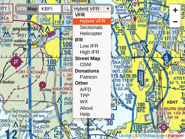
Here you can:
For zooming, you can also use the scrollwheel of your mouse or, in case of iPhone and iPod, pinch-to-zoom gestures.
There are five types of FAA charts in the pull-down menu.
When you zoom in too far, you may see blank tiles with a small gray cross in the middle. These tiles identify areas for which no data is available at the current zoom level.
The original VFR and IFR charts (including legends), as well as a chart guide, are available from the FAA: https://www.faa.gov/air_traffic/flight_info/aeronav/digital_products/aero_guide.At higher zoom levels, you will see small blue dots overlying many airports. These are airport markers. When you click or tap on a marker, you will see the Airport / Facility Directory listing for the corresponding airport, as illustrated below:
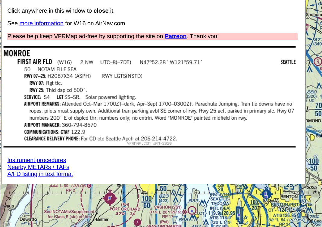
Click or tap anywhere on the listing to close it.
The Airport / Facility Directory can also be accessed using this interface: http://afdsearch.com.