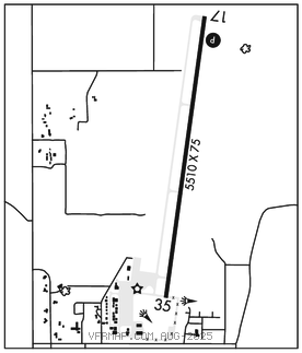
LEMHI CO (SMN)(KSMN) 4 S UTC–7(–6DT) N45°07.40′ W113°52.89′
4044 B NOTAM FILE SMN

RWY 17–35: H5510X75 (ASPH) S–12.5 MIRL
RWY 17: REIL. PAPI(P4L)–GA 3.5° TCH 55′.
RWY 35: REIL.
SERVICE: S4 FUEL 100, JET A LGT ACTIVATE MIRL Rwy 17–35, REIL Rwy 17 and Rwy 35, and PAPI Rwy 17–CTAF.
AIRPORTREMARKS: Attended 1500–0000Z‡. Rwy 17 use rgt tfc pat for ngt ops only. Cold temperature airport. Altitude correction required at or below –12C. Bcn OTS indef.
AIRPORT MANAGER: 208-940-2171
WEATHER DATA SOURCES: AWOS–3PT 135.075 (208) 756–4381.
COMMUNICATIONS: CTAF/UNICOM 122.8
SALMON RCO 122.6 (BOISE RADIO)
®SALT LAKE CENTER APP/DEP CON 132.4
RADIO AIDS TO NAVIGATION: NOTAM FILE SMN.
SALMON (VH) (DH) VORW/DME 113.5 LKT Chan 82 N45°01.28′ W114°05.05′ 042° 10.6 NM to fld. 926013E.
VOR unusable:
127°–135° byd 40 NM
136°–146° byd 40 NM blo 14,000′