LAWTON–FORT SILL RGNL (LAW)(KLAW) 2 S UTC–6(–5DT) N34°34.06′ W98°25.00′
1110 B ARFF Index—See Remarks NOTAM FILE LAW MON Airport
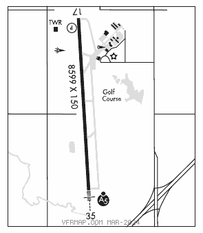
RWY 17–35: H8599X150 (CONC–WC) S–45, D–179, 2S–175, 2D–344 HIRL
RWY 17: REIL. PAPI(P4R)—GA 4.0° TCH 47′. Pole. 0.3% down.
RWY 35: MALSR. 0.6% up.
RUNWAY DECLARED DISTANCE INFORMATION
RWY 17: TORA–8599 TODA–8599 ASDA–8599 LDA–8599
RWY 35: TORA–8599 TODA–8599 ASDA–8599 LDA–8599
SERVICE: S4 FUEL 100LL, JET A1+ OX 1, 2 LGT When ATCT clsd actvt MALSR Rwy 35—CTAF. HIRL Rwy 17–35 preset med intst; incr intst—CTAF.
AIRPORT REMARKS: Attended Mon–Fri 1130–0200Z‡ Sat–Sun 1130–0100Z‡. Birds on and invof arpt. When twr clsd ARFF avbl through Fort Sill apch control. ARFF Index PPR for unsked Part 121 acr ops with more than 30 pax seats–AMGR. Twy F clsd exc acft more than 110,000 lbs. 12 hr PPR 580–585–1321.
AIRPORT MANAGER: 580-353-4869
WEATHER DATA SOURCES: ASOS 120.75 (580) 581–1351.
COMMUNICATIONS: CTAF 119.9 ATIS 120.75 UNICOM 122.95
®FORT SILL APP/DEP CON 120.55
TOWER 119.9 (1400–0100Z‡) GND CON 121.9
CLEARANCEDELIVERYPHONE:When ATCT clsd, for CD ctc Fort Worth ARTCC at 817-858-7584.
AIRSPACE: CLASS D svc 1400–0100Z‡; other times CLASS E.
RADIO AIDS TO NAVIGATION: NOTAM FILE LAW.
(L) (L) VORW/DME 116.85 LAW Chan 115(Y) N34°29.77′ W98°24.79′ 349° 4.3 NM to fld. 1105/9E.
VOR unusable:
270°–305° blo 3,900′
270°–305° byd 10 NM
ILS 109.1 I–LAW Rwy 35. Class IB. Unmonitored when ATCT clsd. Glideslope unusable for coupled apchs blo 2,000′ MSL.
COMM/NAV/WEATHER REMARKS: When twr clsd weather avbl through Fort Sill apch control.