LEWISBURG
GREENBRIER VALLEY (LWB)(KLWB) 3 N UTC–5(–4DT) N37°51.50′ W80°23.97′ 2302 B ARFF Index–See Remarks NOTAM FILE LWB
RWY 04–22: H7003X150 (ASPH–GRVD) S–90, D–120, 2S–152, 2D–160 PCR 360 F/D/X/T HIRL
RWY 04: MALSR.
RWY 22: REIL. PAPI(P4L)–GA 3.0° TCH 58′.
RUNWAY DECLARED DISTANCE INFORMATION
RWY 04: TORA–7003 TODA–7003 ASDA–7003 LDA–7003
RWY 22: TORA–7003 TODA–7003 ASDA–7003 LDA–7003
SERVICE: S2 FUEL 100LL, JET A LGT ACTVT MALSR Rwy 04; REIL Rwy 22; PAPI Rwy 22; HIRL Rwy 04–22; twy lgts–CTAF.
AIRPORT REMARKS: Attended continuously. Birds and deer on and invof arpt. Class I, ARFF Index B. PPR 24 hrs for unscheduled air carrier ops with more than 30 passenger seats call arpt manager 304–645–3961. ARFF Index C equipment avbl upon request. Ldg fee for all acft abv 4000 lbs. Lndg fee waived with appliciable fuel purchase based on acft weight or if acft is registered in the State of West Virginia or fuel purcahase with a U. S. Govt Air Card.
AIRPORT MANAGER: 304-646-7382
WEATHER DATA SOURCES: AWOS–3PT (304) 645–4533
COMMUNICATIONS: CTAF 118.9 UNICOM 122.95 ATIS 121.4
WASHINGTON CENTER APP/DEP CON 134.4
LEWISBURG TOWER 118.9 (1400–0000Z‡) GND CON 121.9
CLNC DEL 125.725 (when twr clsd)
AIRSPACE: CLASS D svc 1400–0000Z‡; other times CLASS G.
RADIO AIDS TO NAVIGATION: NOTAM FILE LWB.
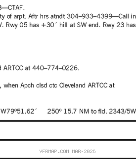
(H) DME 116.05 LWB Chan 107(Y) N37°51.83′ W80°23.51′ at fld. 2338.
DME unusable:
095°–150°
151°–185° byd 20 NM blo 10,000′
186°–196° byd 20 NM blo 7,000′
197°–094° byd 20 NM blo 10,000′
BUSHI NDB (LOM) 346 LW N37°46.94′ W80°28.11′ 044° 5.6 NM to fld. Autopilot cpd apch NA blw 2,770′ MSL.
ILS 110.35 I–LWB Rwy 04. LOM BUSHI NDB. Autopilot cpd apch NA blw 2,770′ MSL. LOC unusable 0.3 NM inbd.
COMM/NAV/WEATHER REMARKS: Use CTAF 118.9 when twr clsd. Freq 121.5 not avbl at twr. If unable to contact Washington Center on 134.4, contact Washington Center on 125.725.