SUFFOLK EXEC (SFQ)(KSFQ) 3 SW UTC–5(–4DT) N36°40.97′ W76°35.98′
70 B NOTAM FILE SFQ
RWY 04–22: H5007X100 (ASPH) S–30, D–60, 2D–60 HIRL
RWY 04: REIL. PAPI(P4L)–GA 3.0° TCH 39′. Tree. Rgt tfc.
RWY 22: REIL. PAPI(P4L)–GA 3.5° TCH 45′. Trees.
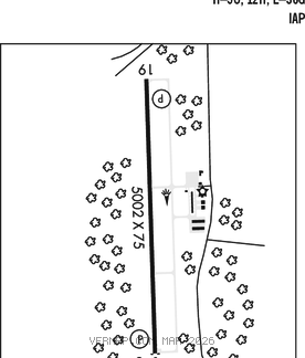
RWY 07–25: H3750X100 (ASPH) S–30, D–50, 2D–85
RWY 07: Tree.
RWY 25: Trees. Rgt tfc.
SERVICE: S4 FUEL 100LL, JET A, MOGAS LGT ACTVT REIL Rwy 04 and Rwy 22; HIRL Rwy 04–22–CTAF.
AIRPORT REMARKS: Attended 1300–2200Z‡. Parachute Jumping. Deer on and invof arpt. Parachute activity on and invof arpt. Rwy 07 rwy end arrow heads painted white instead of designed aviation yellow. Rwy 07 markings faded and poor condition. Rwy 25 markings in poor condition.
AIRPORT MANAGER: 757-514-4411
WEATHER DATA SOURCES: AWOS–3 119.375 (757) 934–3942.
COMMUNICATIONS: CTAF/UNICOM 122.7
®NORFOLK APP/DEP CON 127.9
CLEARANCE DELIVERY PHONE: For CD ctc Norfolk Apch at 757-464-0757.
RADIO AIDS TO NAVIGATION: NOTAM FILE RDU.
COFIELD (L) TACAN Chan 93 CVI (114.6) N36°22.37′ W76°52.29′ 044° 22.8 NM to fld. 65/9W.
TACAN AZIMUTH unusable:
120°–180° byd 25 NM
180°–120° byd 25 NM blo 3,000′
LOC/DME 109.95 I–RKH Chan 36(Y) Rwy 04.