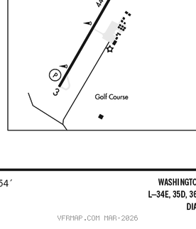
FRANKLIN RGNL (FKN)(KFKN) 2 NE UTC–5(–4DT) N36°42.02′ W76°54.13′
40 B TPA–See Remarks NOTAM FILE FKN
RWY 09–27: H4977X100 (ASPH–GRVD) MIRL
RWY 09: PAPI(P2L)–GA 3.0° TCH 40′. Tree.
RWY 27: PAPI(P2L)–GA 3.0° TCH 40′. Tree.
SERVICE: S4 FUEL 100LL, JET A LGT ACTVT MIRL Rwy 09–27–CTAF. Rwy 27 PAPI unusable byd 1 NM fm thr.
AIRPORT REMARKS: Attended 1300–2200Z‡. Deer on and invof arpt. Possible tfc from the Southampton Memorial Helipad 2 NM west of arpt. TPA–840(800) lgt acft, 1540(1500) hvy acft. Drainage ditches next to rwy & twys. Arpt FBO clsd Sat and Sun.
AIRPORT MANAGER: 757-562-8764
WEATHER DATA SOURCES: AWOS–3PT 124.675 (757) 562–8765.
COMMUNICATIONS: CTAF/UNICOM 122.8
®NORFOLK APP/DEP CON 127.9
CLEARANCE DELIVERY PHONE: For CD ctc Norfolk Apch at 757-464-0757.
RADIO AIDS TO NAVIGATION: NOTAM FILE DCA.
HOPEWELL (VL) (H) VORTACW 114.35 HPW Chan 90(Y) N37°19.73′ W77°06.96′ 171° 39.0 NM to fld. 706W.
VOR unusable:
052°–060° byd 40 NM
100°–105° byd 40 NM
150°–160° byd 40 NM
205°–220° blo 4,500′
225°–242° byd 30 NM blo 6,000′
295°–305° byd 40 NM
330°–345° byd 40 NM