CHASE CITY MUNI (CXE)(KCXE) 2 W UTC–5(–4DT) N36°47.30′ W78°30.09′
503 TPA–1303(800) NOTAM FILE DCA
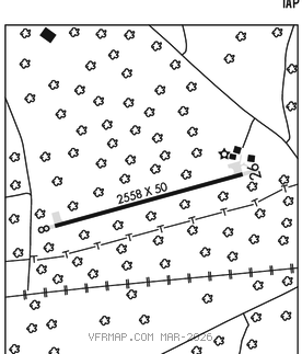
RWY 18–36: H3400X50 (ASPH) S–12.5 0.5% up N
RWY 18: Road.
RWY 36: Brush.
AIRPORT REMARKS: Unattended. Arpt CLOSED SS–SR indef. Deer on and invof arpt. Farm equip operating near rwy. Rwy 18–36 severe cracking. 1–2 inches in places and along cntrln. Rwy 18–36 longitudinal and transverse cracking, some raveling in certain areas.
AIRPORT MANAGER: 434-372-5136
WEATHER DATA SOURCES: AWOS–3 121.225 (434) 372–4506.
COMMUNICATIONS: CTAF 122.9
®WASHINGTON CENTER APP/DEP CON 118.75
CLEARANCE DELIVERY PHONE: For CD ctc Washington ARTCC at 703-771-3587.
RADIO AIDS TO NAVIGATION: NOTAM FILE DCA.
SOUTH BOSTON (L) (L) VORTAC 110.4 SBV Chan 41 N36°40.50′ W79°00.87′ 080° 25.7 NM to fld. 5205W.